


Introduction
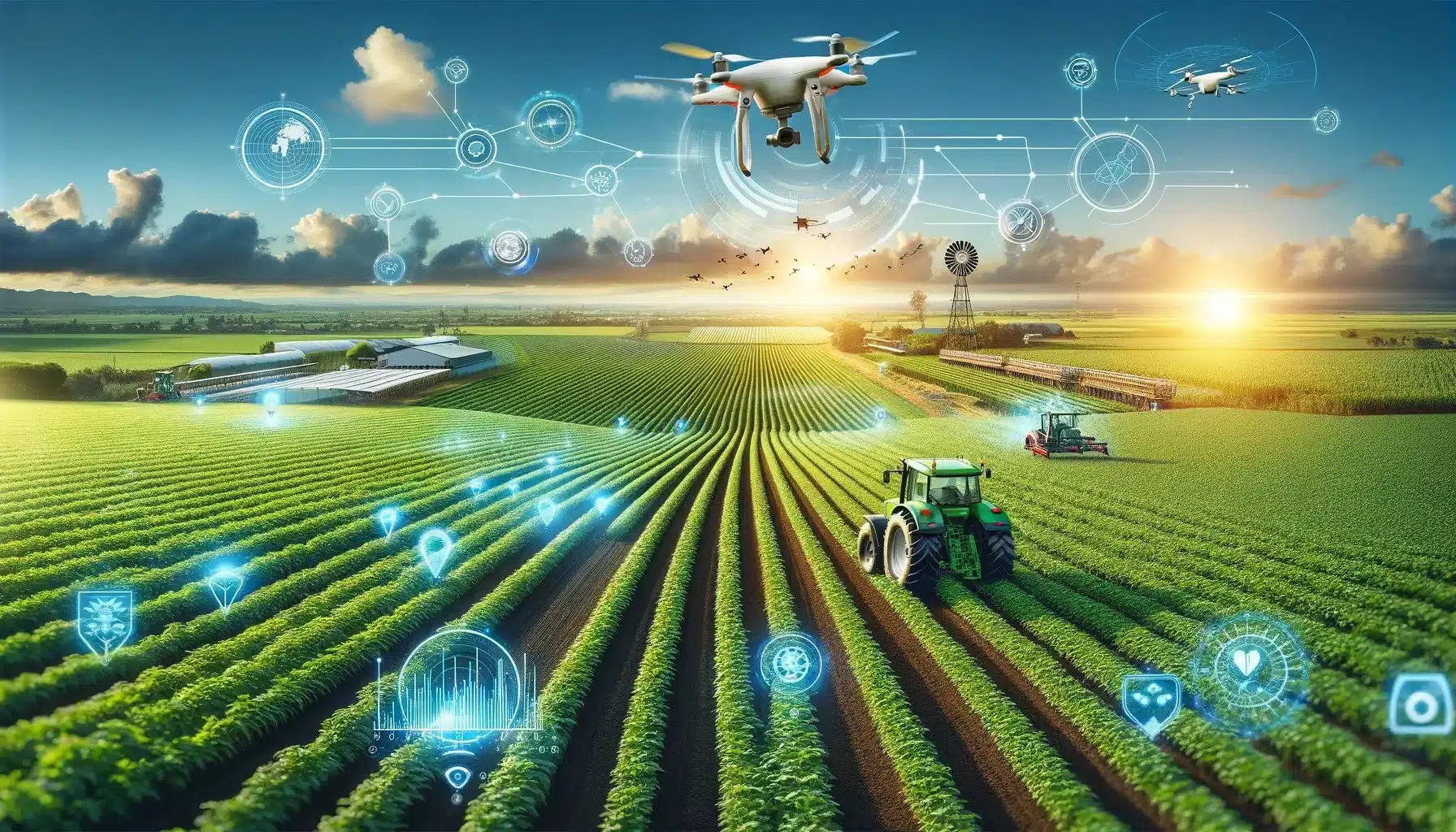
Smart agriculture is revolutionising the way farming is approached and managed, leveraging cutting-edge technology to increase efficiency, productivity, and environmental sustainability. One such innovative technology that drives this transformation is Global Navigation Satellite Systems (GNSS), particularly high-precision GNSS. This advanced system provides critical data that supports a myriad of applications in smart farming––from precision planting to real-time crop monitoring. This blog covers the multifaceted role of high-precision GNSS deployed in modern agriculture.
Understanding High-Precision GNSS: Definition and Components
GNSS refers to a constellation of advanced satellites providing signals from space that transmit positioning and timing data to GNSS receivers. This technology is significant in smart agriculture and utilises a network of satellites to provide accurate location data anywhere on the planet, ultimately facilitating agricultural activities. These systems include the American GPS, Russian GLONASS, European Galileo, and Chinese BeiDou. High-precision GNSS for smart agriculture involves advanced technologies such as Real-Time Kinematic (RTK) positioning, which enhances the accuracy of location data to within a few centimeters.
Comparing High-Precision GNSS with Standard GNSS Technology
High-precision GNSS technology offers superior accuracy compared to standard GNSS systems. While standard GNSS can provide positioning accuracy within several meters (about 10 meters), high-precision GNSS can achieve centimeter-level accuracy. This level of precision is critical in agricultural applications where small-scale variations in terrain, soil composition, and crop health can significantly impact decision-making processes.
Technique Enabling High Precision in GNSS Technology
High-precision GNSS employs various techniques to improve the accuracy of satellite-derived positioning data. Key technologies that enhance GNSS precision include:
- RTK: This technique achieves centimeter-level accuracy by using a fixed base station and a mobile receiver to provide real-time corrections, delivering highly accurate positioning data.
- PPK (Post-Processed Kinematics): This approach involves collecting data points and processing them afterwards to improve the accuracy of the positioning information.
- SBAS (Satellite-Based Augmentation Systems): Systems like WAAS in the U.S. and EGNOS in Europe provide additional corrections via satellite signals to enhance GPS signals, improving accuracy and reliability.
Potential Benefits of High-Precision GNSS in Agriculture
High-precision GNSS offers unparalleled benefits in terms of:
Increased Crop Yields: Economic Impact
The economic implications of integrating high-precision GNSS in agriculture are not just significant; they’re profound. Farmers can achieve substantial cost savings through reduced input usage and labour costs. The improved yield and quality of crops directly translate to higher profits. Moreover, the data collected can be used for better decision-making, further enhancing the economic stability of farming operations. The future of farming is not just sustainable; it’s financially rewarding.
Environmental Benefits
The adoption of high-precision GNSS in agriculture also brings substantial environmental benefits, such as:
- Reduced Chemical Use: Precision in application reduces the quantity of fertilizers and pesticides required, decreasing the likelihood of runoff and leaching, which can contaminate water sources.
- Conservation Tillage: High-precision GNSS supports conservation tillage practices, which reduce soil erosion and improve water retention by minimising the need for repeated soil turnovers.
Data Integration and Management
GNSS data integrates seamlessly with other agricultural technologies, providing a comprehensive overview of farm operations and facilitating informed decision-making.
Exploring Broad Range Applications of High-Precision GNSS in Smart Agriculture
These systems offer a myriad of applications in various areas, from autonomous vehicles to surveying and construction, making a significant impact, including:
Precision Farming with GNSS
High-precision GNSS enables farmers to conduct field operations with unprecedented accuracy. Applications include:
- Seeding and Planting: Automated equipment can place seeds at precisely coordinated positions.
- Soil Sampling: Accurate GPS data allows effective soil sampling by ensuring that samples are taken consistently from the exact location to monitor changes over time.
Yield Mapping and Field Scouting
GNSS technology creates yield maps that help farmers understand variations across their fields. This data can guide decisions on irrigation, pest control, and harvesting. Field scouting with GNSS-equipped devices allows precise monitoring and data collection on crop health and infestation levels.
Automated and Robotic Systems
Automated machinery, such as tractors and drones, rely on high-precision GNSS for navigation and operation without human intervention. This technology improves efficiency, reduces operator fatigue, and increases safety.
Technical and Economic Challenges of High-Precision GNSS
Despite its benefits, high-precision GNSS faces challenges such as signal blockage, high initial costs, technical complexity, regulatory issues, and require technical expertise. Additionally, bespoke systems require more sophisticated equipment and sometimes specific environmental conditions to function optimally. Addressing these issues is crucial for wider adoption, particularly among small-scale farmers.
GNSS-Integrated Smart Agriculture: Future Trends
Advancements in satellite technology and data processing are likely to further enhance the accuracy and reliability of GNSS systems. Coupled with AI and machine learning, GNSS will continue to transform agriculture, making it more productive and sustainable.
Bottom Lines
High-precision GNSS is a cornerstone of smart agriculture, offering precise data that drives efficiency, productivity, and sustainable practices in precision farming. By harnessing the power of satellite-based positioning technology, farmers can make data-driven decisions that optimise resource allocation, mitigate risks, and enhance the overall resilience and profitability of their farming enterprises. Embracing this technology is essential for the next generation of agricultural practices, ensuring food security and environmental health in an ever-changing world for generations to come.
Related posts:
 Raspberry Pi 400 Personal Computer Kit Review
 Raspberry Pi for Home Automation and Integrations
 Battery Safety Circuits: Crucial Components For Your Devices
 A Guide to PCB Connectors for Electronic Applications
 How to Design Low-Power IoT Applications
 RJ45 Connectors Upgradation to Next-Gen Standards
 The Role of Wi-Fi 6 in Automotive Connectivity Evolution
 Wi-Fi 7: A Leap In Fast And Reliable Wireless Connectivity
 Designing A Simple And Compact UPS Utilizing Supercapacitors
 Advanced PCB Designs for USB Hub Connectivity
 IoT Security: Building Resilient Time-Sensitive Networks
 Key Capabilities of Bluetooth LE to Make the Future of Audio


